If you want to live where a coffee run, a lakeside stroll, and a full grocery shop fit into your day without much driving, Reston belongs on your shortlist. The community was designed so you could reach daily needs on foot, and recent changes along the Silver Line have only made it easier. In this guide, you’ll see how Reston’s village centers, 55+ miles of trails, and two Metro stations work together so you can run more errands on foot. You’ll also get practical tips to test walkability for a specific address. Let’s dive in.
Why Reston works for walkers
Reston started with a simple idea: put daily shopping and civic life into village centers so most residents have a short walk for everyday needs. Fairfax County’s comprehensive plan documents that intent and outlines how plazas, ground-floor retail, and pedestrian links should connect people to services. You can see that planning approach in the guidance for the village centers and the town center in the Reston Comprehensive Plan.
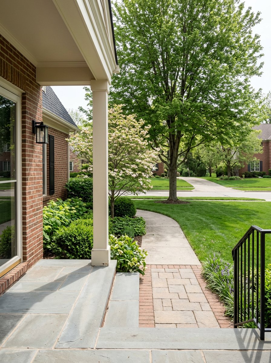
Trails are the backbone of that system. The Reston Association maintains an interconnected network of 55+ miles of paved and natural-surface pathways that link neighborhoods, schools, parks, and village centers. For route ideas and exact connections, use the Reston Association trail resources.
Reston also plugs into the regional Washington and Old Dominion (W&OD) Trail. Recent safety investments, including a grade-separated crossing at Wiehle Avenue, make it easier to bike or walk to Metro and nearby centers. Learn more about the W&OD’s regional reach and improvements from NOVA Parks.
Where you can walk for daily needs
Reston Town Center and the Metro corridor
Reston Town Center (RTC) is the urban core. You get an active street grid, a central plaza, restaurants, fitness studios, services, and growing residential options. Addresses immediately around RTC tend to score high for errands. The Reston page on Walk Score shows that the RTC area often lands in the mid 80s, while Reston overall averages lower.
Grocery choices have concentrated near RTC and the Silver Line. Wegmans opened at Halley Rise on February 1, 2023, which added a large-format grocer right in the RTC-adjacent mix. See the opening details in the Wegmans press release. Whole Foods also relocated to a new site adjacent to Reston Town Center in 2025. Find the store announcement in Whole Foods Market’s release.
Transit matters to walkability too. The Silver Line’s Phase 2 opened for revenue service on November 15, 2022, which added the Reston Town Center station and strengthened RTC and Halley Rise as walkable, transit-oriented areas. For an overview of the extension, see the MWAA Silver Line FAQs.
Lake Anne Village Center
Lake Anne is Reston’s original village center. You get a mid-century plaza along the water, independent coffee and wine spots, arts programming, and a weekly farmers market. Fairfax County recognizes the historic character of the core area, which you can find in the Reston Comprehensive Plan. Expect a local, community-focused feel. Many residents here walk for coffee, dining, and services, then make a short trip for larger supermarket runs.
North Point Village Center
North Point serves as a practical neighborhood hub in North Reston. A Giant grocery anchors the center, with banks, restaurants, and daily services that support frequent short trips. If you want walkability for errands without the higher energy of RTC, this area offers a simpler daily routine. For a property-level summary of the center and tenant anchors, review North Point Village Center’s listing overview.
South Lakes Village Center
South Lakes sits by the water and is anchored by Safeway. You can pair grocery runs with a coffee, sit by Lake Thoreau, and access health and fitness services in the same stop. It is a straightforward daily walk destination for many South Reston homes. See an overview of anchors and services on the South Lakes Village profile.
Hunters Woods Village Center
Hunters Woods is another South Reston hub. It has historically been anchored by Safeway and sits next to the Reston Community Center’s Hunters Woods location, which brings arts and civic programming into the immediate walk-shed. For a snapshot of the center and its co-location with the community center, see the Hunters Woods Village Center page.
Tall Oaks and smaller centers
Some smaller centers, including Tall Oaks, have seen redevelopment or repositioning. County guidance treats these as convenience centers or sites that may evolve over time. If a specific store matters to you, confirm the latest tenant list. Planning context is available in the Reston Comprehensive Plan.
Trails and connections that make it work
The Reston Association trail system is your everyday walking map. Paved spines cut through greenbelts and connect to sidewalks near village centers, parks, and schools. Use the RA trail map tools to find direct routes from your cluster to your closest plaza.
It helps to separate recreational loops from shopping routes. Trails can move you efficiently without traffic, but they do not always end at a storefront entrance. In practice, many residents use trails for most of the distance, then transition to sidewalks for the last block or two. The W&OD Trail adds a longer-distance option for biking and brisk walks. Recent grade separations, such as the Wiehle Avenue bridge, reduce conflicts and make trips to Metro and town center more practical. Read about those improvements at NOVA Parks.
Transit and buses
The Silver Line’s Phase 2 opening in November 2022 reshaped walkability patterns. Areas around the Reston Town Center station and Wiehle–Reston East have stronger walk-to-transit routines, and new blocks near the stations are designed for daily errands on foot. Get a quick overview from the MWAA Silver Line FAQs.
Local bus service links village centers to the stations. That means many addresses function as walkable-plus-short-bus for work or shopping, even if a full supermarket is just beyond your preferred walking radius. This hybrid approach often unlocks car-light living.
Everyday errands you can walk
- RTC and Halley Rise: multiple cafés, services, and two large-format groceries within a short walk, including the 2023 Wegmans opening and the 2025 Whole Foods relocation near the town center. See the Wegmans announcement and Whole Foods opening details.
- North Reston: practical daily errands cluster around North Point Village Center, anchored by Giant, plus banks and eateries. Reference the North Point center overview for a sense of services.
- South Reston: two Safeway-anchored centers serve most daily needs. South Lakes pairs groceries with lakeside seating. Hunters Woods adds civic activity through the Reston Community Center. Learn more from the South Lakes center profile and Hunters Woods summary.
How to test walkability for your address
Use this quick process to see what your daily routine could look like.
- Check Walk Score for the address. The Reston Walk Score page gives a baseline, then drill down to your exact block. Scores near RTC are often highest for errands.
- Map a trail route. Open the Reston Association trail resources and trace a path to your closest village center and to your preferred grocery.
- Time a real-world walk. A 5 to 10 minute walk is roughly 0.25 to 0.6 mile for most people. Test the route at the time of day you plan to use it.
- Try a trail-to-Metro connection. If you plan to commute or shop by rail, test a route that uses the W&OD or an RA pathway to reach the station, then cross at the improved Wiehle segment where applicable.
- Combine walk plus bus if needed. In many Reston clusters, a short walk and a short bus ride fill the gap when a full-service supermarket is just beyond your preferred radius.
Buying or selling with walkability in mind
If you are buying, decide what you want within a 5 to 10 minute walk. Do you want a full grocery, or is a café and pharmacy enough with a weekly drive for bulk shopping? Then narrow to the blocks that put those priorities within reach, especially around RTC, Halley Rise, North Point, South Lakes, and Hunters Woods.
If you are selling, highlight the specific routes and time-tested routines that matter. Show buyers how your home connects to the nearest plaza by trail or sidewalk, which grocery is closest, and how the Silver Line changes commute options. Clear, address-level guidance helps the right buyer see how your home supports a car-light lifestyle.
Ready to align your next move with a walkable routine in Reston? Reach out to Jeff Major Homes for local guidance, address-level walkability checks, and a plan to buy or sell with confidence.
FAQs
Which parts of Reston are most walkable for errands?
- Addresses in and around Reston Town Center and the Silver Line stations tend to score highest on the Reston Walk Score page, while village centers like North Point, South Lakes, and Hunters Woods offer practical daily walkability for groceries and services.
What changed for walkers when the Silver Line Phase 2 opened?
- The November 15, 2022 opening added the Reston Town Center station and strengthened walk-to-transit living near the corridor, as outlined in the MWAA Silver Line FAQs.
How extensive is Reston’s trail system, and does it reach shops?
- The Reston Association maintains 55+ miles of pathways that link neighborhoods to parks, schools, and village centers, with details on the RA trail maps; trails complement sidewalks but may not end at a storefront door.
Is there a regional trail connection that helps with longer trips?
- Yes. The W&OD Trail runs through Reston, and recent grade separations like the Wiehle Avenue bridge improve safety and access to Metro and town center areas, per NOVA Parks.
Where are the major supermarkets clustered for walkable shopping?
- Large-format options sit near the RTC corridor, including Wegmans at Halley Rise and a relocated Whole Foods adjacent to RTC, while North Point (Giant), South Lakes (Safeway), and Hunters Woods (Safeway) anchor neighborhood-scale daily shopping.